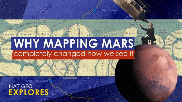
Cartographic Conflicts: How Early Mars Maps Shaped Our Understanding

Welcome to your ultimate source for breaking news, trending updates, and in-depth stories from around the world. Whether it's politics, technology, entertainment, sports, or lifestyle, we bring you real-time updates that keep you informed and ahead of the curve.
Our team works tirelessly to ensure you never miss a moment. From the latest developments in global events to the most talked-about topics on social media, our news platform is designed to deliver accurate and timely information, all in one place.
Stay in the know and join thousands of readers who trust us for reliable, up-to-date content. Explore our expertly curated articles and dive deeper into the stories that matter to you. Visit NewsOneSMADCSTDO now and be part of the conversation. Don't miss out on the headlines that shape our world!
Table of Contents
Cartographic Conflicts: How Early Mars Maps Shaped (and Mis-shaped) Our Understanding of the Red Planet
The rusty landscapes of Mars have captivated humanity for centuries. But our understanding of this enigmatic planet wasn't built overnight. Early Martian cartography, riddled with limitations and speculation, played a crucial role in shaping – and sometimes mis-shaping – our perception of the Red Planet. From speculative canals to groundbreaking robotic explorations, the evolution of Mars mapping offers a fascinating glimpse into the history of scientific discovery and the inherent challenges of exploring the unknown.
The Era of Speculation: Schiaparelli and the Martian Canals
The late 19th and early 20th centuries saw a surge in astronomical observation, fueled by advancements in telescope technology. Giovanni Schiaparelli's observations in the 1870s, detailing what he termed "canali" (channels) on Mars, ignited a firestorm of speculation. While Schiaparelli cautiously described linear features, the English translation, "canals," evoked images of artificial waterways, sparking fervent debates about the possibility of Martian civilization. These early maps, heavily influenced by the "canals" interpretation, significantly impacted public perception and fueled decades of science fiction narratives. The legacy of Schiaparelli's maps serves as a potent reminder of how interpretation can profoundly influence scientific understanding, particularly when dealing with limited observational data.
Mariner and Viking: The Dawn of Robotic Cartography
The space race of the mid-20th century ushered in a new era of Martian exploration. The Mariner and Viking missions, launching in the 1960s and 70s, provided the first close-up images of Mars, revolutionizing our understanding of its geology and topography. These missions generated significantly more accurate maps, replacing speculative drawings with detailed images of craters, volcanoes, and canyons. The initial maps created from these missions, while far more accurate than their predecessors, still had limitations due to the relatively low resolution of the images. Nevertheless, they laid the foundation for future, more detailed cartographic endeavors. This shift from terrestrial observation to robotic exploration marked a critical turning point in Martian science.
The High-Resolution Revolution: Mars Global Surveyor and Beyond
The late 20th and early 21st centuries witnessed a dramatic improvement in Mars mapping technology. Missions like the Mars Global Surveyor, with its high-resolution cameras, produced incredibly detailed maps, revealing intricate geological features previously unseen. These advancements allowed scientists to accurately chart the planet's surface, identifying vast canyons like Valles Marineris and massive volcanoes like Olympus Mons with unprecedented precision. This era also saw the rise of digital cartography, allowing for the creation of interactive, three-dimensional models of Mars, significantly enhancing scientific analysis and public engagement.
- Improved Resolution: High-resolution images provided unparalleled detail, revealing complex geological features.
- Digital Cartography: Interactive 3D models allowed for a deeper understanding of Martian topography.
- Global Coverage: Comprehensive mapping efforts provided complete surface coverage.
Ongoing Exploration and Future Mapping
Mars exploration continues to evolve. Current and future missions, including those involving rovers like Perseverance and orbiters like Mars Reconnaissance Orbiter, are collecting vast amounts of data, leading to ever-more accurate and refined maps. These ongoing efforts not only improve our understanding of Mars' past and present but also inform future exploration strategies, including the potential for human missions. The ongoing creation and refinement of Martian maps represent a testament to humanity's persistent curiosity and our unwavering drive to unravel the mysteries of the cosmos. The history of Martian cartography reminds us that scientific knowledge is a constantly evolving process, shaped by technological advancements and the ongoing interplay between observation, interpretation, and innovation.

Thank you for visiting our website, your trusted source for the latest updates and in-depth coverage on Cartographic Conflicts: How Early Mars Maps Shaped Our Understanding. We're committed to keeping you informed with timely and accurate information to meet your curiosity and needs.
If you have any questions, suggestions, or feedback, we'd love to hear from you. Your insights are valuable to us and help us improve to serve you better. Feel free to reach out through our contact page.
Don't forget to bookmark our website and check back regularly for the latest headlines and trending topics. See you next time, and thank you for being part of our growing community!
Featured Posts
-
 Uber Rating System Update Low Scores Result In Account Termination
Feb 28, 2025
 -
 Why Scientific Research Matters In War Zones Episode 3
Feb 28, 2025
 -
 Hot Wheels Unveils Metal Mario Release Date And Collector Details
Feb 28, 2025
 -
 Aoc Reveals Death Threats Following Offensive Baseball Team Video
Feb 28, 2025
 -
 Death Threats Against Aoc Escalate After Controversial Baseball Video Surfaces
Feb 28, 2025
