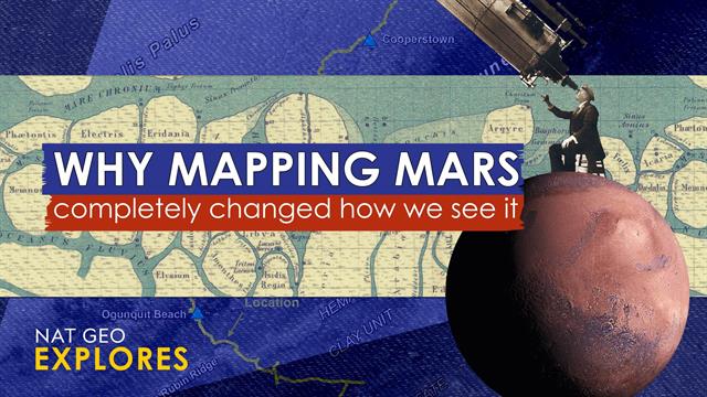
The Contentious Creation Of Mars Maps: A History Of Scientific Debate

Welcome to your ultimate source for breaking news, trending updates, and in-depth stories from around the world. Whether it's politics, technology, entertainment, sports, or lifestyle, we bring you real-time updates that keep you informed and ahead of the curve.
Our team works tirelessly to ensure you never miss a moment. From the latest developments in global events to the most talked-about topics on social media, our news platform is designed to deliver accurate and timely information, all in one place.
Stay in the know and join thousands of readers who trust us for reliable, up-to-date content. Explore our expertly curated articles and dive deeper into the stories that matter to you. Visit NewsOneSMADCSTDO now and be part of the conversation. Don't miss out on the headlines that shape our world!
Table of Contents
The Contentious Creation of Mars Maps: A History of Scientific Debate
For centuries, Mars has captivated humanity, fueling our imaginations and inspiring countless works of science fiction. But the quest to understand the Red Planet hasn't been a straightforward journey; creating accurate and comprehensive Mars maps has been a long, arduous, and often contentious process, riddled with scientific debate and evolving technologies. From early telescopic observations to sophisticated robotic missions, the history of Mars cartography is a fascinating story of human ingenuity, perseverance, and the ever-evolving nature of scientific discovery.
Early Days: Telescopic Speculation and the "Canals" Controversy
The earliest attempts to map Mars relied heavily on telescopic observations, a challenging task given the planet's distance and atmospheric conditions. Early maps, created in the 17th and 18th centuries, were rudimentary, depicting only basic surface features. However, the late 19th and early 20th centuries saw a surge in interest, fueled by the controversial observations of Percival Lowell. Lowell's claim to have observed intricate networks of "canals" on Mars sparked intense debate within the scientific community. While some embraced his findings, suggesting evidence of intelligent life, others attributed the "canals" to optical illusions or atmospheric distortions. This debate significantly impacted the early development of Mars cartography, highlighting the limitations of early observational techniques and the subjectivity inherent in interpreting astronomical data.
The Space Age Revolution: Robotic Missions and High-Resolution Imaging
The launch of robotic missions to Mars in the late 20th century revolutionized our understanding of the planet and dramatically improved the accuracy of Martian maps. Missions like Mariner 4, Mariner 9, and the Viking orbiters provided the first high-resolution images of the Martian surface, revealing a complex landscape far removed from Lowell's canals. These missions produced significantly more detailed and accurate maps, showcasing vast volcanoes, deep canyons, and evidence of past water activity. The data collected became the foundation for subsequent mapping efforts, ushering in a new era of precision in Mars cartography.
Modern Mapping: Global Datasets and Ongoing Debate
Today, Mars mapping is a sophisticated endeavor involving the integration of data from multiple sources – orbiting spacecraft, rovers, and landers. Global datasets combine high-resolution imagery with topographic data, creating three-dimensional models of the Martian landscape. However, even with advanced technology, challenges remain. Interpreting geological features, understanding the planet's history, and accurately depicting subtle changes require ongoing scientific debate and collaboration. The ongoing discussion concerning the presence and extent of subsurface water ice, for example, directly influences the accuracy and interpretation of Mars maps.
The Future of Mars Mapping: Collaboration and Continuous Refinement
The future of Mars mapping hinges on continued exploration and technological advancement. Future missions, such as the Mars Sample Return campaign, will provide even more detailed data, leading to further refinements in our understanding of the planet's geology and history. International collaboration will be key, fostering the sharing of data and expertise to create the most comprehensive and accurate Martian maps possible. As we continue to explore Mars, the process of map creation will undoubtedly remain a dynamic and evolving field, driven by scientific curiosity and technological innovation. This continuous refinement and collaborative effort will be essential to unlocking the secrets held within the Red Planet's captivating landscape.
Keywords: Mars, Mars maps, Mars cartography, planetary science, space exploration, robotic missions, Percival Lowell, canals, high-resolution imaging, global datasets, scientific debate, Martian geology, space technology, Mars Sample Return.

Thank you for visiting our website, your trusted source for the latest updates and in-depth coverage on The Contentious Creation Of Mars Maps: A History Of Scientific Debate. We're committed to keeping you informed with timely and accurate information to meet your curiosity and needs.
If you have any questions, suggestions, or feedback, we'd love to hear from you. Your insights are valuable to us and help us improve to serve you better. Feel free to reach out through our contact page.
Don't forget to bookmark our website and check back regularly for the latest headlines and trending topics. See you next time, and thank you for being part of our growing community!
Featured Posts
-
 From Tongue To Technology The Science Behind Reproduced Taste Experiences
Apr 08, 2025
 -
 Shootout Victory For Abbotsford Canucks Over Laval Rocket 3 2
Apr 08, 2025
 -
 Mayday Over Australia Details Emerge From Pilots Urgent Call
Apr 08, 2025
 -
 Dalios Stark Warning Tariffs Mask A Fundamental Us China Power Shift
Apr 08, 2025
 -
 Wordle Solution Archive Search By Date Or Alphabetical Order
Apr 08, 2025
